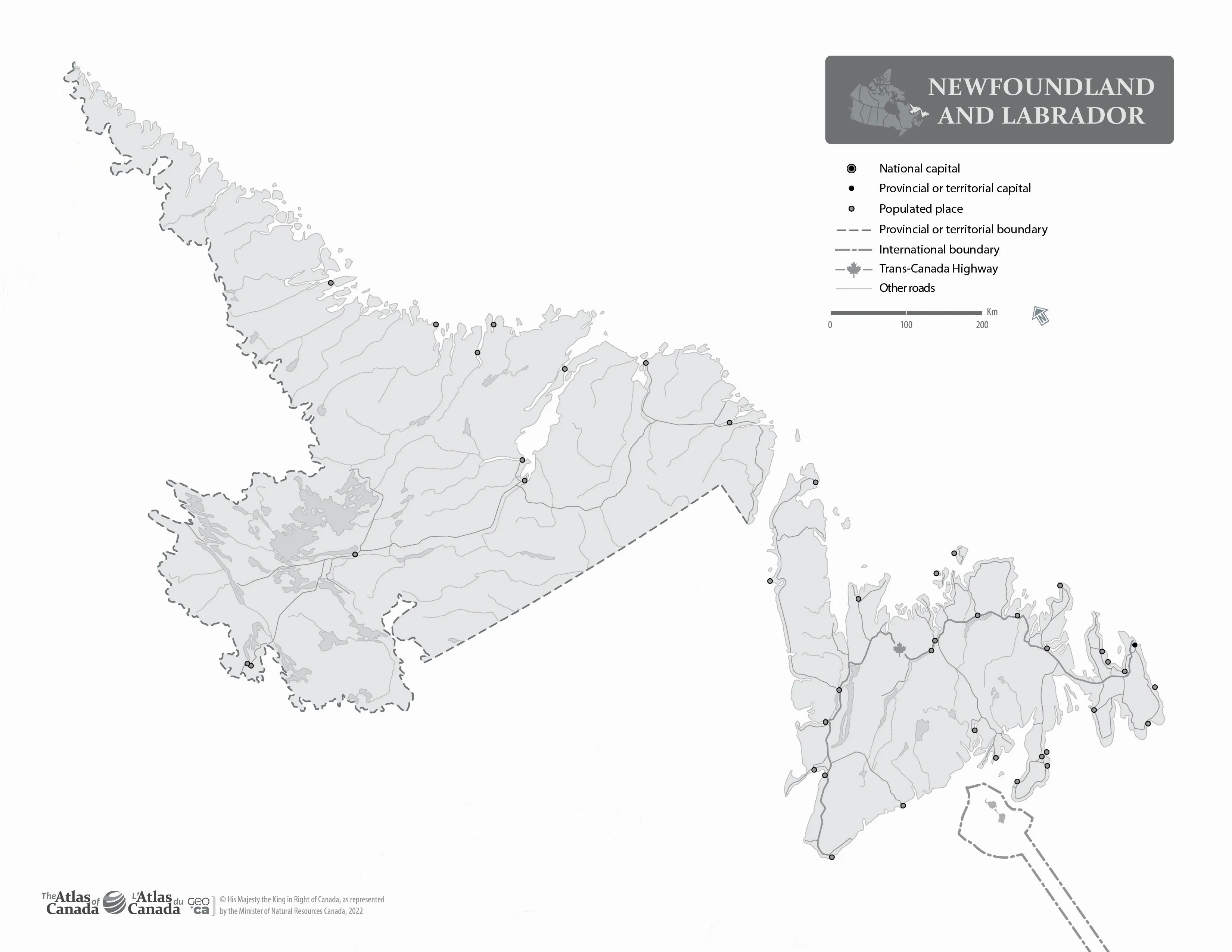
Welcome to the download page of Canada Maps, where Newfoundland and Labrador without Names Map are free to download in both printable JPG and PDF file formats. Whether you’re planning a road trip, researching a project, or want to understand better the political or geographical Canada, our collection of maps has got you covered.
About Newfoundland and Labrador without the names map
The outline map of Newfoundland and Labrador without the names of major political and geographical features is a simplified yet informative representation of the region’s geography. The map highlights Newfoundland and Labrador’s boundary, coastline, and major water systems, including its lakes and rivers.
The map can be used for various purposes, including education, research, and recreational activities. In educational settings, the map can help students understand the geography of Newfoundland and Labrador, its water systems, and the impact of human activity on the region’s natural resources. The map can also be used in research to analyze and monitor the region’s water quality and ecology.
For outdoor enthusiasts and tourists, the map can be a valuable tool for exploring the region’s water systems and planning outdoor activities such as fishing, boating, kayaking, and discovering new regions. The map can also be useful for residents of Newfoundland and Labrador who want to explore their region or plan outdoor activities.
In addition, the map can be valuable for businesses that operate in the region, including those in the fishing, shipping, and tourism industries. These industries rely on Newfoundland and Labrador’s water systems for transportation, production, and recreation.
Overall, the outline map of Newfoundland and Labrador without the names of major political and geographical features provides a simplified yet informative view of the region’s significant water systems. It is a valuable tool for exploring, studying, and appreciating the natural beauty of Newfoundland and Labrador’s water resources.

The image is a map of Newfoundland and Labrador, a province in Canada. This reference map focuses on the geographical features of Newfoundland and Labrador. It measures 3300 pixels in width and 2550 pixels in height and is presented in the WebP format.
The map displays the physical geography of Newfoundland and Labrador without any labels. This would include the province’s distinctive features, such as its rugged coastline, numerous lakes, and the varied topography of both the island of Newfoundland and the mainland region of Labrador. The absence of labels makes this map particularly useful for educational purposes, such as studying the province’s geography or for use as a base map for adding specific annotations or information.
The image’s high resolution ensures that the geographical details of Newfoundland and Labrador are clearly visible, making it a valuable resource for anyone interested in the natural landscape of this Canadian province.
Download link for Outline map Newfoundland and Labrador without Names – English printable JPG.
Download link for Outline map Newfoundland and Labrador without Names – English printable PDF.
Looking for more similar maps to Newfoundland and Labrador without Names for printing? Check them out here.
Downloading these maps is easy and hassle-free. Select the map you want, choose the file format that works best for you, and hit the download button. These Canada-related maps are designed to be printer-friendly, so you can print them out at home or take them to a local print shop.
Use cases for the Newfoundland and Labrador without Names Map
The outline map of Newfoundland and Labrador without the names of major political and geographical features has various use cases, including:
- Educational purposes: The map can be used in educational settings to teach students about the geography of Newfoundland and Labrador and its major water systems. It can also be helpful for educators who want to teach about the region’s history and relationship with water resources.
- Environmental studies: The map can be used in environmental studies and research to analyze the impact of human activity on the region’s water resources, monitor water quality, or study the ecology of different water systems in the region.
- Recreational activities: The map can be useful for tourists who want to explore the natural beauty of Newfoundland and Labrador’s water systems and plan outdoor activities such as fishing, boating, and kayaking. It can also be useful for residents of the region who want to plan outdoor activities or explore new regions.
- Business and commerce: The map can be valuable for businesses that operate in the region, including those in the fishing, shipping, and tourism industries, which rely on Newfoundland and Labrador’s water systems for transportation and production.
- Art and design: The map can be used by artists and designers for creative purposes, such as creating illustrations or graphic designs related to the geography of Newfoundland and Labrador.
Overall, the outline map of Newfoundland and Labrador without the names of major political and geographical features provides a simplified yet informative view of the region’s significant water systems, highlighting their ecological, economic, and cultural importance. The map can be used for various purposes by individuals and organizations, providing a valuable tool for exploring, studying, and appreciating the natural beauty of Newfoundland and Labrador’s water resources.
We are committed to providing high-quality, informative maps accessible to everyone. These Canada maps are available for personal or educational purposes, and we encourage you to share them with your friends and colleagues.
Driving Directions, Google Maps, and more
To use these services, please visit the Driving Directions, Google Maps, or OpenStreetMap pages.
Provinces and territories
If you are looking for detailed information on the Canadian provinces and territories, consult the following pages: Alberta, British Columbia, Manitoba, New Brunswick, Newfoundland and Labrador, Northwest Territories, Nova Scotia, Nunavut, Ontario, Prince Edward Island, Quebec, Saskatchewan, and the Yukon.
The map of Newfoundland and Labrador without the names above contains information licensed under the Open Government Licence – Canada.
Thank you for visiting Canada Maps! We hope our maps will help you explore and discover the beauty of Canada.