Hiking

Home » Hiking

Where is the Yukon?

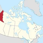
Nestled in the northern reaches of Canada, the Yukon is a vast and captivating territory that boasts an awe-inspiring landscape. Spread across approximately 482,443 square kilometers, it is larger than many countries! Located in Northwest Canada, the Yukon shares its borders with Alaska to the west, British Columbia to the south, and the Beaufort Sea to the north.
Home » Hiking

Discovering Della Falls – Canada’s Highest Waterfall

Della Falls, located in Strathcona Provincial Park, British Columbia, Canada, is truly a remarkable natural wonder. Regarded as the highest waterfall in Canada, it stands tall at 440 meters high (1,444 feet), cascading down from the Della Lake and pouring into the Drinkwater Creek below. The falls are fed by the snowmelt and rainwater that collects in the lake during the spring and summer months, creating a breathtaking sight for visitors who venture to this remote part of Vancouver Island. To witness the full splendor of the falls, adventurous hikers can take on the challenging but rewarding eight-hour hike that winds through the lush rainforest and rugged terrain, rewarding them with unparalleled views of the stunning landscape and the awe-inspiring Della Falls. Not only a natural spectacle, but Della Falls is also an important symbol of Canada’s rich ecological heritage, reminding us of nature’s immense beauty and power.

Home » Hiking

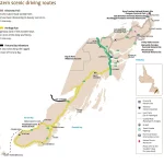
Discover Eastern Newfoundland’s Natural Beauty with this Scenic Driving Route Map

This map shows cities, towns, trails, Trans-Canada highways, secondary roads, national parks, provincial parks, provincial visitor information centers, provincial/national historic sites, ferries, airports, and natural scenic attractions in Eastern Newfoundland.

Home » Hiking

Explore Eastern Newfoundland with a Comprehensive Tourist Map

This map shows cities, towns, the Trans-Canada highway, secondary roads, national parks, provincial parks, campgrounds, provincial/national historic sites, airports, local ferries, summer ferries, ski areas, golf courses, and provincial visitor information centers in Eastern Newfoundland.

Home » Hiking

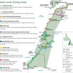
Discover the Beauty of Western Newfoundland with Scenic Driving Routes

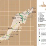
This map shows cities, towns, trails, Trans-Canada highways, secondary roads, national parks, provincial parks, provincial visitor information centers, provincial/national historic sites, ferries, airports, and natural scenic attractions in Western Newfoundland.

Home » Hiking

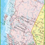
Explore the Best of British Columbia: A Detailed Map of Cities, Towns, and Natural Wonders

This map shows cities, towns, rivers, lakes, the Trans-Canada highway, major highways, secondary roads, winter roads, railways, and national parks in British Columbia.

Home » Hiking

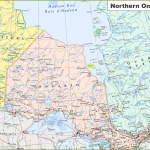
Discover Northern Ontario: A Map Guide to the Natural Wonders of the Region

This map shows cities, towns, rivers, lakes, national parks, major roads, minor roads, railways, and the Trans-Canada highway in Northern Ontario.

Home » Hiking

Canmore, Alberta: Your Gateway to Adventure in the Rockies

Canmore is a small town located just outside of Banff National Park, known for its stunning mountain views and outdoor activities. Visitors can hike, bike, or ski in the nearby mountains, and enjoy the town’s cozy cafes, shops, and restaurants.

Home » Hiking

Exploring the Natural Beauty of Gaspé Peninsula, Quebec: A Hidden Gem in Eastern Canada

The Gaspé Peninsula is a scenic region in eastern Quebec that is home to rugged coastlines, charming fishing villages, and stunning national parks. It’s a great destination for outdoor enthusiasts, offering activities such as hiking, fishing, and sea kayaking.